
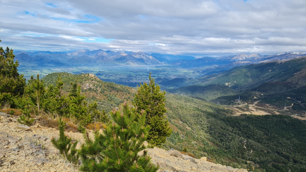
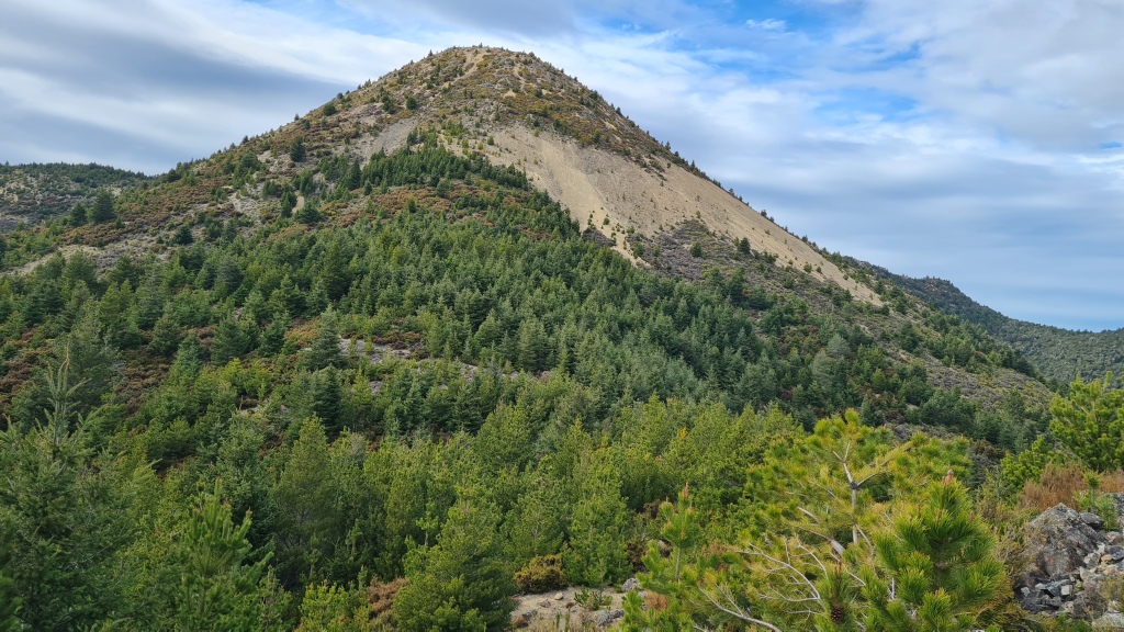
CB-573 sits in the Hanmer range above the Hanmer Springs village. Although not a long walk (4km) or particularly steep (only 400m vertical), its difficulty lay in the fact there was no track and no obvious route in. It was one that had defeated me a couple of years ago.
John ZL3MR asked me if I was interested in having another crack at it, to which I was, but unfortunately I couldn’t be in Hanmer when he was due to start. In fact I only made it up there just before he made the summit! Since I couldn’t do it with him I decided to have a go the next morning (but not before shouting him a beer at a local pub to get the inside word on where to go)
Access is via an access road cut to reach the power grid that runs through the area, via Jollies Pass Road. The issue though was to work out the best part of the access road to have a go from. Following John’s instructions I parked up at the bottom of the road and walked up. I decided to go up the way he came down as it sounded easier. This meant turning in when I reached the second pylon which was on the road.
Immediately I found a simple naturally formed track to follow up and then used John’s gpx file he had sent me to lead me to the top. As John warned me the track did disappear at times but apart from a wee bit of bush bashing it was a relatively straight forward climb. There was a wonderful view across the Hanmer basin from the top.
The biggest surprise of the day was the summit having trees on it! ZL3/CB is not known for this and as far as I could remember it was only the second time I had activated a summit with any. Admittedly they were wilding pines which are a total pest but it made it easy to bungee my pole and gave me shelter from the sun to boot.
This activation was also notable for the fact I worked no one on 2m for the first time ever, (the fact I managed to put my alert up for an hour later than I meant to probably didn’t help). Jumping on HF I got my 4 QSOs on 60m and then several ZLs on 40m CW. 20m CW yielded VK1DA and a JA. The highlight was working JM1PJX/1 on 15m CW. He was a genuine 559 and sounded as surprised as me.

Packing up I headed down the hill and made the mistake of not following John’s gpx closely enough or remembering the track, such as it is, does easily disappear at times. That meant some bush bashing I should have avoided. Getting back to his track I then promptly did the same thing again! Coming down took me 30 minutes longer than going up and shredded my legs. Lesson learned!
Getting there: From Hanmer Springs, if you have a 4 wheel drive you can go up Jollies Pass Road. The Pylon road on the far side of the pass, a third of the way down to your right. I parked there although a decent 4 wheel drive could probably get you to the pylon where you could park. The road is quite rough in parts. If you have a two wheel drive car go over Jacks pass and drive around to Jollies Pass Road. The pylon road loops back to Jollies Pass road near the start of it. Park there and follow the road. You may have to cross a stream.
Time to the top. 90min to three hours (depending on how far off track you end up).
Cell Coverage: Yes Vodafone and Spark 4G. You can actually see the tower in the village.

Repeaters: You can easily hit 705 in Christchurch. 2m simplex seems patchy and John noted he couldn’t hear anyone in North Canterbury but Christchurch itself was OK. I had the same issue.
Trig: Not that I could find.
Permission: None needed as conservation land.

